
Boise ID Land Surveying Services
Offering a variety of land surveying services including cell tower, FEMA surveys and more for residential & commercial customers. 208-342-7957
Fox Land Surveys, Inc. provides high quality, professional land surveying services for a wide variety of clients including Cell Tower Providers, Utility Companies, Pipeline Contractors, the Mining industry, developers and builders, as well as individual homeowners throughout Boise, Idaho and surrounding areas.
Cell Tower Surveys
 We offer Cell Tower survey services in Idaho, Oregon, Nevada, Utah, Wyoming, and Montana. We perform surveys for the following types of projects: Lease Sites, ALTA, As-built, Boundary, Cadastral, Easement, Global Positioning, Photogrammetric, Topographic and Federal Emergency Management Surveys (FEMA).
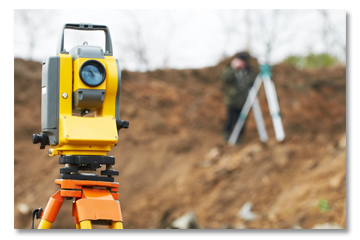
Utility Surveys
Our experienced team of surveyors have also worked on Utility surveying services including Aerial Control and Photogrammetric surveys, ALTA, As-built, Boundary, Cable Run, Cadastral, Dam Monitoring, Easement, Federal Emergency Management (FEMA), Global Positioning, Pipe Line and Topographic surveys.
Mining and Reclamation Surveys
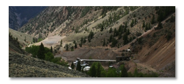 Mining surveys establish or recover the Boundaries and Corners of claims. Reclamation surveys are performed in planning and restoration of the land. Our related survey services include mining claim, topographic, volumetric, as-built, construction and hazardous waste site surveys.
Commercial Surveys
 We also specialize in a wide variety of commercial surveys including Global Positioning, Topographic, ALTA, As-built, Boundary, Subdivision, Property Split, Property Line Adjustment, Property Line Determination, Cadastral, Easement, Elevation Certificate (FEMA) and Federal Emergency Management Surveys (FEMA).
Developer Surveys
At Fox Land Surveys, Inc. we are dedicated to providing high-quality surveys throughout Boise, ID and the surrounding areas. Our Developer Survey services include Global Positioning, Topographic, ALTA, As-built, Boundary, Subdivision, Property Split, Property Line Adjustment, Property Line Determination, Cadastral, Easement, Elevation Certificate (FEMA) and Federal Emergency Management Surveys
FEMA Surveys: Elevation Certificates
 Do you need a FEMA Elevation Certificate? We offer a wide variety of professional land surveying services and can customize a scope to meet your needs, large or small. Our FEMA Survey Services include Elevation Certificates (FEMA), Conditional Letter of Map Amendments (CLOMA), Conditional Letter of Map Revision-Based on Fill (CLOMR-F), Electronic Letter of Map Amendment (E-LOMA), Letter of Map Amendments (LOMA), and Letter of Map Revision (LOMR-F)
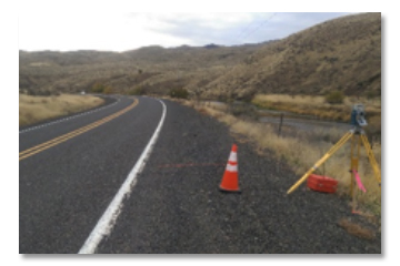
Highway Surveys
We also specialize in highway survey services including Aerial, Boundary and Right-of-Way, Cadastral, Construction, Global Positioning and Topographic surveys. Our highly trained and experienced team is ready to help with all of your highway surveying needs. Call us today for more information.
Residential Surveys
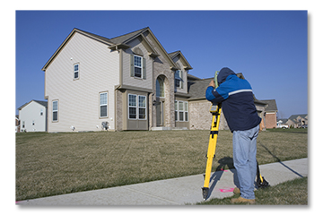 We also work on a wide variety of residential survey services. These services include ALTA, As-built, Boundary, Subdivision, Property Split and Property Line Adjustments, Property Line Determination, Cadastral, Easement, Elevation Certificate (FEMA), Federal Emergency Management Surveys (FEMA), Global Positioning and Topographic surveys.
Public Entity Surveys
Fox Land Surveys, Inc. also specializes in Public Entity Surveys, government/civil surveys services throughout Idaho. These include ALTA, As-built, Boundary, Subdivision, Property Split and Property Line Adjustments, Property Line Determination, Cadastral, Easement, Elevation Certificate (FEMA), Federal Emergency Management Surveys (FEMA), Global Positioning and Topographic, Construction and Forensic surveys.
Forensic Surveys
 We also provide Forensic Surveys for Traffic Accident scenes, Utilities, and Boundaries. We use Global Positioning, Robotic Total Stations, the internet, and CAD drafting techniques to provide our clients with the accurate, detailed mapping this type of work requires.


